
Ohio Airports
|
 Major Ohio airports include the Akron-Canton Airport in North Canton,
the Cincinnati/Northern Kentucky International Airport located in Covington, Kentucky,
the Cleveland Hopkins International Airport,
the Dayton International Airport,
the Port Columbus International Airport,
the Rickenbacker International Airport in Columbus, and
the Toledo Express Airport.
Major Ohio airports include the Akron-Canton Airport in North Canton,
the Cincinnati/Northern Kentucky International Airport located in Covington, Kentucky,
the Cleveland Hopkins International Airport,
the Dayton International Airport,
the Port Columbus International Airport,
the Rickenbacker International Airport in Columbus, and
the Toledo Express Airport.
The photo to the right is an aerial view of Put-In-Bay Airport on South Bass Island.
Interactive Ohio Airports Map
This section features an airport locator map that can be zoomed and panned to show the state of Ohio and its neighbors or a small region of the state. Use the plus (+) and minus (-) buttons to zoom the map in and out, respectively. Simply swipe or drag the map to pan it in any direction. The airport markers on this Ohio map can help travelers find IATA-designated airports in the state and plan their air travel arrangements more efficiently.
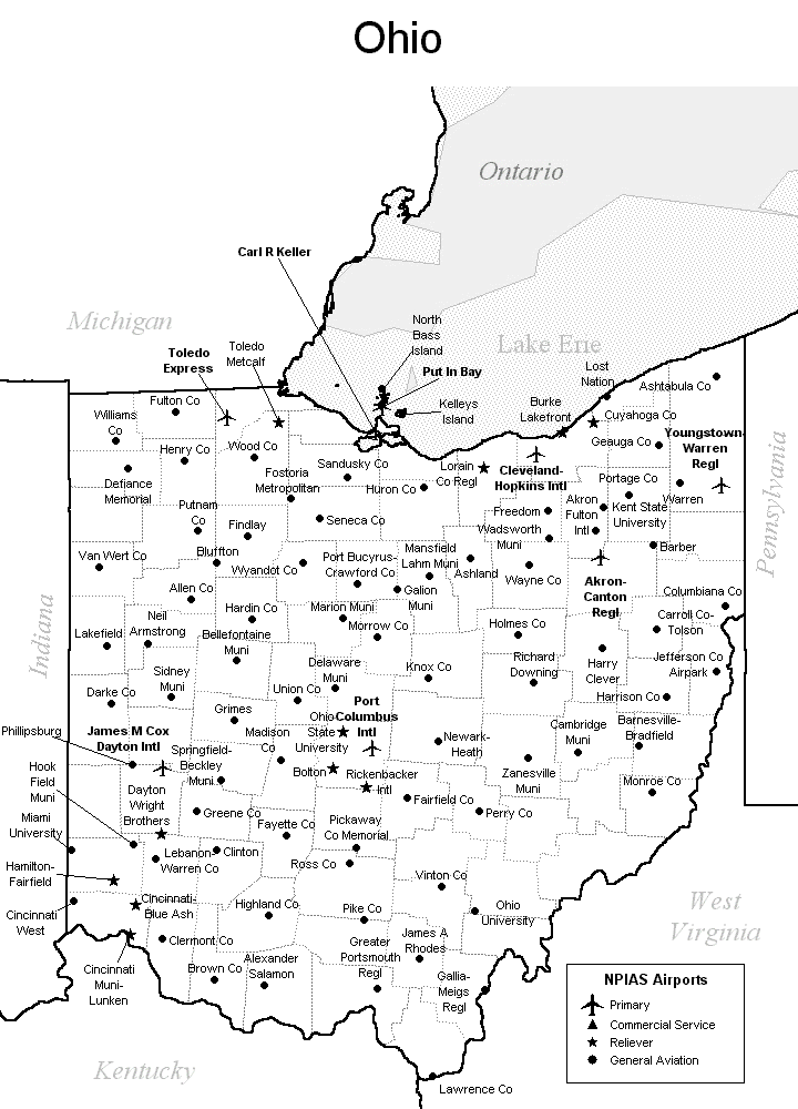
FAA Ohio Airport Locator Map
This Ohio airport map shows FAA-designated commercial service airports, reliever airports, and general aviation airports in the State of Ohio. Primary airports are designated with an airplane symbol.
Copyright © State-Maps.org. All rights reserved.
Ohio airport map source: FAA 2001-2005 NPIAS.
Ohio airport map source: FAA 2001-2005 NPIAS.